WEATHER PROGNOSIS
MeteoSwiss
General situation Prognosis Emagram
Isobar maps
source: meteonews.netWind and precipitation
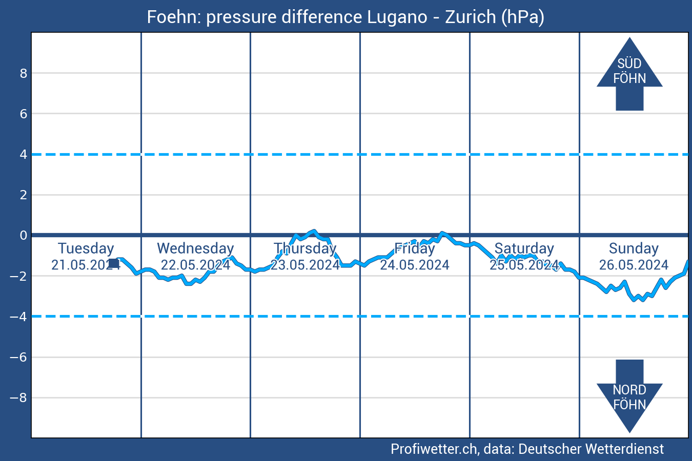
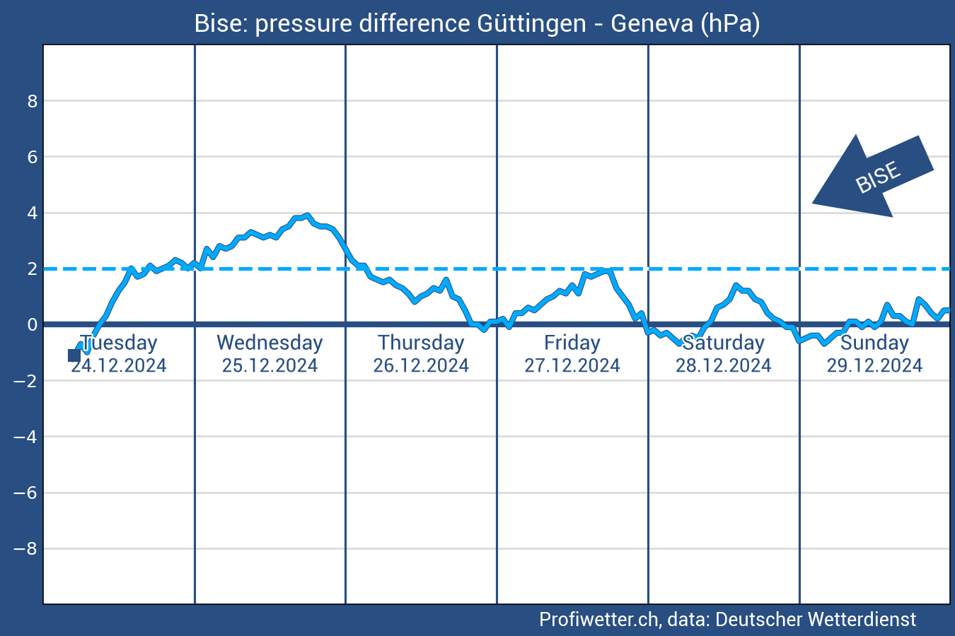
source: xctherm.comPressure difference
source: profiwetter.ch

Potential High-fog ceiling

Wind current situation
source: winds.mobiParaglidable Forecast
source: paraglidable.comMeteo five point check
Plan your next day accordingly! Safety begins at home, and thorough preparation is key. Make informed decisions by checking the latest meteorological forecasts. Our preparation page supports you with essential information for both meteorological conditions and airspace considerations. You can find further links at the useful links section. It's crucial to stay ahead of the curve and prioritize safety before taking flight. Explore the resources available here to ensure a comprehensive pre-flight preparation. Make it a habit to check the Meteo and Airspace information every time before you embark on your journey into the skies. Your commitment to preparation is an integral part of a safe and enjoyable flying experience.
The "Meteo 5 point check" what we use for our daily preparation is based on the SHV's "Decision making strategy".
Do not forget: YOU are the pilot, YOU make your decisions! It is your way.
Weather checklist - keywords & alarm signals
| Front | Föhn | Wind (Nation-wide) | Wind (Regional) | Thunderstorms-Precipitation | |
|---|---|---|---|---|---|
| Text prognosis | Kaltfront, Okklusion, Störung, Kaltluft, Sturmtief, Westlage | N-Alps: Föhn, Süd-föhn, Südwind, Föhntendenz; S-Alps: Nordföhn, Nordwind | Mässiger Wind aus Westen, Nordwesten, Südwesten, Bise, Nordwind, Ostwind, böiger Wind | Mässiger oder starker Talwind | Wärme-/Hitze-, Gewitter, Tagesgangwetter, Schauer, Überentwicklungen, Labile Luft |
| Isobar maps | Front is approaching, West wind situation | Steep pressure gradient | Shallow deep pressure situation | ||
| Wind forecast | 2000m AMSL, 800m AGL: The Föhn-channels are visible 3000m AMSL, 4000m AMSL: Wind in the Alpine arc meets the mountain range at a right angle. (Note: Does not apply to shallow foehn conditions!) |
Too strong winds | 10m, 800m AGL: Strong valley winds in long-wide valleys, Nation-wide wind could increase the valley winds | ||
| Pressure difference | (N-S), Well pronounced overpressure or increasing pressure tendency on the LUV side of the Alps | (West-East): >2 hPa pressure difference, increasing tendency | |||
| Precipitation forecast | Coherent precipitation zone is approaching my region | Patchy pattern with locally high rainfall intensity | |||
| Temperature forecast | Cold air moves towards me, T drop in the forecast | Colder airmass on the LUV side of the alps | |||
| Date | Labilization due to warming during the day (especially spring & Summer) | April-October, afternoons | |||
| Place, topography | The valley starts with a Pass in the main Alpine ridge (Föhntäler!) | Terrain, nation-wide wind canalizing potential | Alpine pump regions, Turbulent regions, Venturi effect | ||
| Emagram - Prévitemp | Air mass on the LUV side at the top and above the pass is cooler: from 1-2°C. In the case of "shallow-föhn", this area above the pass can be small. | Cloud development, Cb forming potential, CAPE (Convective Available Potential Energy) | |||
| Other | Meteo maps: Rain / storm symbols on the map | Föhn index from Meteo Stations; Showing the current situations. 0: No Föhn, 1: Föhntendency, 2: Föhn |